
Last updated: March 2026
Escape the Crowds and Discover Your Next Adventure
Are you tired of navigating Instagram-famous trails elbow-to-elbow with other hikers? Dreaming of discovering places where the only sounds are birdsong and rustling leaves? You’re not alone. While millions flock to Yosemite’s Half Dome or Peru’s Inca Trail, countless secret hikes and underrated hiking trails around the world offer equally stunning scenery—without the crowds, permits chaos, or trail congestion.
From hidden valleys in New Zealand to remote canyons in the American Southwest, these off the beaten path hikes deliver the solitude and raw natural beauty that make hiking truly transformative. Whether you’re an experienced backpacker or weekend escapist seeking something special, this guide will introduce you to trails that feel like your own private paradise.
Lace up your hiking boots, grab your Road Atlas, and get ready to explore some of the world’s best-kept hiking secrets.
*This post may contain affiliate links. If you use them, I may earn a small commission at no extra cost to you.
Table of Contents
Why Some Trails Remain Hidden Gems: The Psychology of Popular vs. Overlooked Routes
Before we dive into specific trails, it’s worth understanding why some incredible hikes remain relatively unknown while others become overcrowded tourist magnets.
1. Social Media Algorithms Favor the Familiar
Instagram and TikTok amplify already-popular destinations, creating a feedback loop. Trails with iconic photo opportunities (think Antelope Canyon or Angels Landing) go viral, while equally beautiful but less photogenic trails stay under the radar.
2. Difficult Access = Fewer Visitors
Many hidden trails require longer drives, rough roads, or multiple-day commitments. The Enchanted Valley in Olympic National Park, for example, sits 13 miles from the nearest trailhead—too far for casual day-trippers but perfect for those seeking solitude.
3. Lack of Marketing and Infrastructure
Popular trails often have visitor centers, shuttle systems, and heavy promotion by tourism boards. Remote trails in places like Sweden’s Sarek National Park have minimal infrastructure, making them less accessible but wonderfully wild.
4. Geographic Overshadowing
Some trails exist near major attractions and get eclipsed. Gros Morne’s coastal trail, for instance, is overshadowed by the park’s famous Western Brook Pond boat tours, even though it offers arguably better scenery.
5. Permit Restrictions and Limited Information
When trails have complex permit systems or scarce online information, many hikers simply move on to easier-to-plan alternatives.
6. Physical Difficulty Filters the Crowds
Strenuous elevation gain, technical scrambling, or multi-day requirements naturally limit traffic. Most hikers prefer moderate, accessible trails, leaving challenging routes beautifully empty.
The Ultimate List: 15 Secret Hikes Around the World
1. Enchanted Valley Trail, Olympic National Park (Washington, USA)
Distance/Elevation: 13 miles round trip to the Chalet, ~500 ft elevation gain
Difficulty: Moderate
Why it’s hidden: Located on the park’s quieter western side, this trail requires a longer drive from Seattle than popular Hurricane Ridge. The relatively flat terrain also means it doesn’t appear on “epic” hiking lists, despite its magical old-growth forest setting.
Detailed Highlights:
- The Enchanted Valley Chalet: This historic 1930s backcountry lodge (now unstable and off-limits inside) sits dramatically against steep valley walls
- Valley of 10,000 Waterfalls: Seasonal cascades tumble from hanging valleys high above the trail
- Old-growth cathedral: Massive Sitka spruce and western hemlock create a canopy draped in club moss and ferns
- Wildlife encounters: Black bears feed on salmon in the Quinault River; Roosevelt elk browse in meadows
- Primitive camping: Backcountry sites let you wake to mountain views and complete silence
Best time: July through September for snow-free access and wildflower blooms
Insider tip: Start at Graves Creek trailhead; the first few miles parallel the Quinault River with soothing water sounds.
Essential gear: Waterproof hiking boots, bear-resistant food canister, rain jacket
2. Gros Morne Coastal Trail (Newfoundland, Canada)
Distance/Elevation: 16 km (10 miles) one-way, ~800 m elevation gain
Difficulty: Moderate to strenuous
Why it’s hidden: Most visitors to Gros Morne National Park focus on the boat tour of Western Brook Pond or the geological marvel of the Tablelands. This coastal gem requires shuttle logistics (or arranging a car pickup), which deters casual hikers.
Detailed Highlights:
- Fjord-like coastal scenery: Dramatic cliffs plunge into the Gulf of St. Lawrence
- Boreal forest immersion: Walk through stunted fir, birch, and aromatic Labrador tea plants
- Marine wildlife: Harbor seals sun on rocky outcrops; minke whales sometimes visible offshore
- Iceberg spotting: In late spring and early summer, icebergs drift past in stunning displays
- Wild berries: Blueberries, bakeapples (cloudberries), and partridgeberries ripen in late summer
- Backcountry camping: Primitive sites at Snug Harbour offer ocean views
Best time: Mid-July to early October for stable weather and berry season
Insider tip: Check the Parks Canada website for trail conditions and shuttle times between trailheads.
Essential gear: Trekking poles for steep sections, wildlife identification guide, windproof layers
3. Karanga Route to Barranco Camp, Mount Kilimanjaro (Tanzania)

Distance/Elevation: 8 km, ~800 m elevation gain
Difficulty: Moderate (altitude dependent)
Why it’s hidden: The Karanga Route is less promoted by tour operators who favor the busier Machame and Marangu routes. It’s often combined with other routes rather than marketed as its own experience, making it fly under the radar.
Detailed Highlights:
- Dramatic valley views: Unique perspective of Kilimanjaro’s southern glaciers and the Kersten Glacier
- Quieter acclimatization: Better “climb high, sleep low” profile with fewer trekkers
- Chagga village sightings: Traditional homesteads visible in valleys below, showing local life
- Alpine desert landscape: Transition from heath to alpine zone with unique flora
- Barranco Camp itself: One of Kilimanjaro’s most scenic camps, beneath the Barranco Wall
- Better summit success rates: The route’s acclimatization profile improves your chances
Best time: January to March (dry season) or June to October
Insider tip: Book with operators who specialize in less-crowded routes for better guide-to-client ratios.
Essential gear: High-altitude sleeping bag, altitude sickness medication, UV protection sunglasses
Resources: Check Tanzania National Parks for permits and regulations.
4. Mount Tamalpais West Ridge Loop (California, USA)
Distance/Elevation: 11 miles loop, ~3,000 ft elevation gain
Difficulty: Strenuous
Why it’s hidden: Mount Tam is beloved by Bay Area locals, but most visitors stick to the easy summit drives or the popular East Peak trails. The West Ridge demands significantly more effort, filtering out casual hikers despite offering superior views and solitude.
Detailed Highlights:
- San Francisco Bay panoramas: On clear days, see the Golden Gate Bridge, San Francisco skyline, and Pacific Ocean
- Old-growth redwood groves: Pockets of ancient trees in sheltered canyons
- Spring wildflower explosion: California poppies, lupines, and Indian paintbrush blanket hillsides
- Varied terrain: Mix of fire roads, single track, coastal scrub, and forest
- Mountain biking culture: Share trails respectfully with local cyclists (they’re friendly!)
- Historic fire lookouts: Remnants of old fire-watching stations dot ridgelines
Best time: Year-round accessibility; March to May for wildflowers; fall for clearer skies
Insider tip: Start early from Pan Toll Station to claim parking and avoid afternoon fog.
Essential gear: Sun hat and sunscreen, hydration pack for long waterless sections, trail running shoes if you prefer speed
Resources: Mount Tamalpais State Park trail map
5. Skútustaðagígar Pseudocrater Trail (Mývatn, Iceland)
Distance/Elevation: 4 km loop, minimal elevation gain
Difficulty: Easy
Why it’s hidden: Iceland’s Ring Road pulls tourists to waterfalls and glaciers, while specialized geological sites like this get overlooked. Most travelers rushing between Akureyri and Egilsstaðir don’t realize these formations are unique worldwide.
Detailed Highlights:
- Rootless volcanic cones: Formed when lava flowed over wetlands, causing steam explosions that created craters
- Emerald crater lakes: Vivid green water fills several pseudocraters
- Birdwatcher’s paradise: Arctic terns, barrow’s goldeneye ducks, and gyrfalcons nest here
- Mývatn geothermal area nearby: Combine with nearby Hverir mud pots and Grjótagjá cave
- Unique geology lesson: See volcanic features found in few places on Earth
- Midnight sun hiking: In summer, hike at any hour under 24-hour daylight
Best time: June to September for accessible trails and nesting birds
Insider tip: Visit during the brief wildflower bloom (late June-July) when the landscape transforms.
Essential gear: Windproof jacket (always windy), binoculars for birds, camera with polarizing filter
Resources: Mývatn visitor information
6. Kawah Ijen Crater Rim Complete Loop (Java, Indonesia)

Distance/Elevation: 10 km loop, ~600 m elevation gain
Difficulty: Moderate
Why it’s hidden: Most tour groups visit solely for the famous blue flames at night, then immediately descend. The full rim walk at sunrise reveals panoramic views that 95% of visitors never see.
Detailed Highlights:
- Electric-blue sulfur flames: Best seen in darkness (2-4 AM hikes)
- Turquoise acidic crater lake: The world’s largest highly acidic lake, an otherworldly sight
- Sulfur miners: Witness workers carrying heavy loads of yellow sulfur up steep paths
- Sunrise over volcanoes: See neighboring volcanic peaks emerge from clouds
- Complete crater perspective: The full rim walk offers 360-degree views
- Fumaroles and vents: Active volcanic features releasing sulfurous gases
Best time: Dry season (April to October); arrive by 2 AM for blue flames then stay for sunrise
Insider tip: Bring a gas mask or wet cloth—sulfur fumes are intense near the crater.
Essential gear: Headlamp with extra batteries, hiking poles for ash slopes, respiratory protection
7. Rapadalen Valley Trek to Sarektjåkkå Glacier (Sarek National Park, Sweden)
Distance/Elevation: 80 km one-way (multi-day expedition), ~1,400 m cumulative gain
Difficulty: Expert only
Why it’s hidden: Sarek is deliberately kept roadless and trail-less, accessible only to experienced wilderness navigators. No huts, no marked paths, no rescue services—making it one of Europe’s last true wilderness areas.
Detailed Highlights:
- Absolute wilderness: Not a single building or marked trail for 80 km
- Hundred peaks: Sarek contains roughly 100 glaciated peaks over 1,800m
- Reindeer and predators: Wild reindeer herds, plus wolverines, lynx, and golden eagles
- Glacier walking: Approach Sarektjåkkå and other active glaciers
- River crossings: Multiple glacial rivers requiring packraft or careful wading
- Midnight sun: Hike in 24-hour daylight in July
- Northern lights: Autumn hikes offer aurora viewing opportunities
Best time: Mid-July to early August only (snow-free and lower water levels)
Insider tip: This is NOT for beginners. Consider hiring a Swedish Mountain Guide for your first Sarek experience.
Essential gear: Packraft for river crossings, GPS device with downloaded maps, comprehensive first aid kit, satellite communicator
8. Kolukkumalai Tea Estate Trek (Tamil Nadu/Kerala Border, India)

Distance/Elevation: 14 km round trip, ~1,200 m elevation gain
Difficulty: Moderate to strenuous
Why it’s hidden: India’s hill stations are popular, but high-elevation tea estate trails rarely appear in international guidebooks. Most tourists stick to Munnar’s lower elevation plantations, missing this spectacular high-altitude experience.
Detailed Highlights:
- World’s highest organic tea estates: At 2,400m elevation, produces unique high-altitude tea
- Sea of clouds phenomenon: Watch clouds fill valleys below at sunrise
- Tamil Nadu-Kerala border views: See both states from ridge viewpoints
- Working tea factory: Visit the 70-year-old orthodox tea factory (world’s highest)
- Indigenous tribal villages: Muthuvan and Paliyan communities maintain traditional lifestyles
- Grassland ecosystems: Shola forests and grassland mosaics unique to Western Ghats
- Wildlife potential: Nilgiri tahr (mountain goats), elephants, and leopards inhabit the area
Best time: November to March (post-monsoon, clear skies); avoid June-September monsoons
Insider tip: Hire a local jeep to the trailhead—the road is extremely rough and 4WD required.
Essential gear: Warm layers for altitude, sun protection, tea sampling containers
Resources: Munnar tourist information centers can arrange guides and jeep transport.
9. Pelican Butte via Lost Lake Trail (Oregon, USA)
Distance/Elevation: 10 miles loop, ~1,500 ft elevation gain
Difficulty: Moderate
Why it’s hidden: Located in the shadow of Crater Lake National Park (just 30 miles away), this trail in Winema-Fremont National Forest sees a fraction of the traffic. Most travelers bypass it entirely, heading straight for Crater Lake’s famous rim.
Detailed Highlights:
- Lost Lake reflections: Crystal-clear alpine lake mirrors surrounding peaks
- Pelican Butte summit: 360-degree views including Crater Lake, Mount Shasta, and Klamath Basin
- Old-growth mountain hemlock: Ancient trees create cathedral-like groves
- Volcanic landscapes: Pumice fields and volcanic rock formations
- Wildflower meadows: July brings avalanche lilies, lupines, and paintbrush
- Solitude guaranteed: You might not see another hiker all day
- Wildlife: Black bears, deer, and occasional elk sightings
Best time: July to September (snow-free access)
Insider tip: Combine with a visit to Crater Lake in early morning, then hike here in afternoon when Crater Lake crowds peak.
Essential gear: Bear spray, water filter for lake water, overnight gear if backpacking
10. Silfra Fissure Drywalk (Þingvellir National Park, Iceland)
Distance/Elevation: 0.5 km underwater walk, minimal elevation
Difficulty: Easy (if you can swim)
Why it’s hidden: Most people know Silfra as a snorkeling/diving site, but few realize that guided drysuit “walking” tours exist. It’s marketed as diving, so hikers miss this unique experience entirely.
Detailed Highlights:
- Walk between continents: Literally between the North American and Eurasian tectonic plates
- Crystal clarity: Over 100 meters visibility in glacial meltwater
- Year-round 2-4°C water: Drysuit keeps you warm in freezing water
- Geological wonder: See exposed continental rift from inside
- UNESCO World Heritage Site: Historical significance as Iceland’s ancient parliament location
- Underwater photography: Unique opportunity for surreal images
- No swimming required: Drysuit buoyancy means you float effortlessly
Best time: Year-round; winter offers Northern Lights potential nearby
Insider tip: Book in advance—tours are limited and fill up. Winter slots are easier to get.
Essential gear: Provided by tour operators (drysuit, weights, etc.); bring waterproof camera
Resources: Þingvellir National Park official site
11. Ausangate Rainbow Mountain Back Route (Cusco Region, Peru)
Distance/Elevation: 25 km, ~900m elevation gain over 2-3 days
Difficulty: Strenuous (high altitude)
Why it’s hidden: While Vinicunca (Rainbow Mountain) now draws crowds via the standard route, the traditional multi-day trek from the back side via Ausangate Circuit remains blissfully empty. The longer commitment and higher altitude deter most tourists.
Detailed Highlights:
- Rainbow Mountain without crowds: Approach from the opposite direction before day-trippers arrive
- Ausangate glacial lakes: Turquoise lakes beneath the sacred peak
- Andean communities: Authentic villages where Quechua culture thrives
- Alpaca and llama herds: Pastoral scenes unchanged for centuries
- Hot springs: Natural thermal pools for soaking tired muscles
- 6,000m peaks: Views of Ausangate (6,384m) and neighboring giants
- Starry nights: High-altitude camping under Milky Way brilliance
Best time: May to September (dry season)
Insider tip: Acclimatize in Cusco for at least 3 days before attempting this high-altitude trek.
Essential gear: Four-season sleeping bag, altitude medication, insulated sleeping pad
12. Pantoll to Stinson Beach via Steep Ravine (California, USA)
Distance/Elevation: 7 miles one-way, ~2,000 ft descent
Difficulty: Moderate
Why it’s hidden: This trail requires shuttle logistics (or a 7-mile climb back), which discourages casual hikers. It’s also overshadowed by more famous Marin County trails like the Dipsea.
Detailed Highlights:
- Redwood canyon descent: Follow Webb Creek through fern-filled ravines
- Ladder sections: Wooden ladders add adventure to the descent
- Coastal arrival: End at gorgeous Stinson Beach for a celebratory swim
- Waterfalls: Seasonal cascades after winter rains
- Banana slugs and newts: Pacific Northwest forest creatures
- Webb Creek ecology: One of Marin’s healthiest creek ecosystems
Best time: Spring (February-May) for waterfalls and green hillsides
Insider tip: Use Marin Transit bus service to shuttle back to Pantoll, or arrange a car drop.
Essential gear: Hiking poles for steep descent, swimsuit for beach arrival
13. Zion Narrows from Chamberlain’s Ranch (Utah, USA)
Distance/Elevation: 16 miles one-way, ~300 ft elevation change
Difficulty: Moderate
Why it’s hidden: Most people hike the Narrows from the bottom as a day hike. The full top-down experience requires permits, shuttle arrangements, and overnight camping—adding complexity that filters crowds.
Detailed Highlights:
- 16 miles of canyon immersion: Walk through the Virgin River surrounded by 2,000-foot walls
- 85% fewer people: Dramatically less crowded than bottom-up day hikes
- Backcountry camping: Primitive campsites in side canyons
- Orderville Canyon: Side canyon with swimming sections
- Better photography: Morning light in deep canyon sections
- Wilderness permit experience: Learn backcountry skills
Best time: June to September (water levels permissible but check forecasts)
Insider tip: Book permits exactly when they become available—they sell out instantly for summer weekends.
Essential gear: Canyon shoes and neoprene socks, waterproof dry bags, hiking poles for river crossing
Resources: Zion National Park wilderness permits
14. Abel Tasman Coast Track Southern Section (New Zealand)
Distance/Elevation: 21 km (Totaranui to Marahau), minimal elevation
Difficulty: Easy to moderate
Why it’s hidden: While the northern sections of Abel Tasman get day-tripper crowds, the southern half sees far fewer people. Most visitors just do short walks near Marahau or take water taxis to popular beaches.
Detailed Highlights:
- Golden beaches: Secluded coves with golden sand and turquoise water
- Tidal crossings: Time your hike with tides to cross estuaries
- Native bush: Coastal forest with nikau palms, tree ferns, and tui birds
- Seal colonies: New Zealand fur seals on rocky platforms
- Overnight huts: DOC huts provide shelter and social atmosphere
- Sea kayaking combo: Consider combining hiking with kayak sections
Best time: October to April (summer); book huts well in advance
Insider tip: Walk south to north for better beach arrivals and easier tidal timing.
Essential gear: Tide watch or tide table, sandals for water crossings, reef-safe sunscreen
15. Tour du Mont Blanc – Italian Side Variants (Italy/France border)
Distance/Elevation: Various (full TMB is 170 km)
Difficulty: Moderate to strenuous
Why it’s hidden: The main TMB circuit is famous, but Italian-side variants like Val Ferret Superior and Grand Col Ferret alternatives see a fraction of the traffic. Most trekkers stick to the standard route.
Detailed Highlights:
- Alpine meadows: Flower-filled pastures with grazing cows and bells
- Refugio culture: Family-run mountain huts with amazing Italian food
- Glacier views: Mont Blanc massif from less-photographed angles
- Quieter trails: Escape the TMB crowds while still doing “the loop”
- Traditional villages: Stone houses and ancient farming practices
- Wildlife: Ibex, chamois, marmots, and golden eagles
Best time: Late June to early September
Insider tip: Book Italian refugios directly—they’re cheaper and more authentic than booking services.
Essential gear: Lightweight microspikes for snow patches, European hiking guide, euro coins for refugio showers
Essential Tips for Hiking Secret Trails Successfully
1. Research Beyond Google’s First Page
- Join hiking forums like r/WildernessBackpacking, WhiteBlaze.net, or regional groups
- Read guidebooks—many hidden trails only appear in printed resources
- Use apps like AllTrails, but filter for trails with fewer reviews
- Contact local ranger stations for insider recommendations
2. Develop Self-Sufficiency Skills
Hidden trails mean fewer rescue resources. Invest in:
- Wilderness First Aid certification
- Navigation skills (map, compass, GPS)
- Water purification systems
- Emergency shelter and fire-starting tools
3. Practice Leave No Trace Principles Religiously
Less infrastructure means more fragile ecosystems:
- Pack out ALL waste, including toilet paper
- Camp on durable surfaces only
- Keep noise levels down
- Don’t share exact locations on social media (use general area tags)
- Stay on established paths even when trails are faint
4. Time Your Visits Strategically
- Hike midweek vs. weekends
- Target shoulder seasons (early/late season)
- Start dawn hikes to beat any crowds
- Avoid holiday weekends
5. Master Permit and Logistics
- Set calendar reminders for when permits open
- Understand shuttle requirements
- Build buffer days for weather delays
- Have backup plans when permits don’t work out
6. Gear Up Properly
The Ten Essentials:
- Navigation tools (map, compass, GPS)
- Sun protection
- Insulation (extra clothes)
- Illumination (headlamp)
- First-aid supplies
- Fire starter
- Repair kit and tools
- Nutrition (extra food)
- Hydration (extra water + treatment)
- Emergency shelter
7. Tell Someone Your Plans
- File detailed trip plans with a trusted person
- Use satellite communicators in remote areas
- Check in at ranger stations when available
- Understand cell coverage limitations
8. Respect Local Communities and Cultures
- Hire local guides when appropriate
- Buy from local businesses
- Learn basic phrases in local languages
- Understand cultural sensitivities around sacred sites
How to Find Hidden Hiking Trails (Without the Crowds)
Many hikers assume all the best trails are already famous, but that’s far from true. Thousands of incredible hiking routes receive very little traffic simply because they are harder to discover online.
Before heading into remote terrain, it helps to estimate how difficult the trail will be. Tools like a hiking difficulty calculator can help you evaluate elevation gain, distance, and terrain.
If you want to find hidden hiking trails, use these proven strategies.
1. Look Beyond the First Page of Google
Most hikers stop after the first few search results. But local blogs, trail reports, and forum discussions often reveal incredible routes that never appear in mainstream travel guides.
Try searching phrases like:
- underrated hiking trails
- hidden hiking trails near me
- less crowded hikes in [region]
These searches often reveal routes that are just as beautiful as famous trails.
2. Use Trail Apps with Low Review Counts
Apps like AllTrails and Gaia GPS are great discovery tools, but instead of sorting by popularity, try filtering for trails with fewer reviews.
Many amazing routes remain quiet simply because they haven’t gone viral yet.
3. Explore National Forests Instead of National Parks
National parks attract millions of visitors each year, while nearby national forests often contain equally beautiful trails with far fewer hikers.
These areas usually have:
- fewer permits
- fewer crowds
- more remote routes
4. Follow Local Hiking Communities
Local hikers often know secret trails that never appear in travel blogs.
Places to look include:
- regional hiking Facebook groups
- Reddit hiking communities
- local outdoor clubs
- ranger station recommendations
5. Use Topographic Maps to Spot Hidden Routes
Sometimes the best trails aren’t promoted online at all.
Studying topographic maps can reveal:
- remote lakes
- ridge routes
- old forest service trails
These routes can lead to incredible scenery that most hikers never see.
How to Discover Hidden Trails While Exploring
Want to discover trails that rarely appear in travel guides or online lists? Many of the best hidden hikes are found through exploration and local knowledge rather than search engines.
Here are a few strategies experienced hikers use to uncover truly secret trails.
Look for “Transition Zone” Trails
Trails that connect popular destinations often receive far less attention than the destinations themselves.
For example, while millions visit Yosemite National Park or Sequoia National Park, far fewer hikers explore the remote routes that lie between them.
These transition zones often contain spectacular scenery without the crowds.
Explore National Forests Instead of National Parks
Many hikers head straight to famous national parks, but nearby national forests often offer equally impressive landscapes with far fewer visitors.
These areas typically have:
- fewer entry restrictions
- more backcountry trails
- quieter trailheads
For hikers looking to escape crowds, national forests can be some of the best places to start exploring.
Consider Less Popular Hiking Regions
Some of the world’s best trails exist outside the most famous hiking destinations.
While countries like Norway attract huge numbers of hikers each year, incredible mountain landscapes can also be found in places like Bulgaria, North Macedonia, and Albania.
These regions often offer dramatic scenery, authentic cultural experiences, and far fewer crowds.
Use the “3-Hour Rule”
One simple rule experienced hikers follow is distance from major cities.
Trails located more than three hours away from large urban centers usually receive significantly less traffic. The extra travel time filters out casual visitors and leaves the trail mostly to dedicated hikers.
Talk to Local Hikers and Outdoor Clubs
Some of the best hidden trails never appear on popular hiking websites.
Local hiking clubs, outdoor stores, and ranger stations often know about lesser-known routes that visitors rarely discover on their own. Connecting with these communities can lead to incredible trail recommendations you won’t find online.
When exploring lesser-known routes, it’s important to estimate how demanding the hike will be. Tools like a hiking difficulty calculator can help you evaluate distance, elevation gain, and terrain before heading out.
Hidden Hiking Trails by Difficulty Level
One of the easiest ways to discover lesser-known hiking routes is to choose trails that match your current skill level. Many famous hikes attract crowds because they are accessible to beginners, but hidden trails often require slightly more preparation or experience.
Before choosing a remote trail, it helps to estimate how demanding the route will be. You can use a hiking difficulty calculator to evaluate factors like distance, elevation gain, and terrain.
Below are examples of hidden gems categorized by difficulty so you can find a trail that matches your ability.
Beginner Hidden Hiking Trails
If you’re new to hiking or just want a relaxed adventure, look for trails that are shorter, well-marked, and have minimal elevation gain.
Some beginner-friendly hidden gems include:
- Skútustaðagígar Pseudocrater Trail (Iceland) – A short loop around rare volcanic formations with incredible views and very little climbing.
- Abel Tasman Southern Coast Track (New Zealand) – Quiet beaches, gentle terrain, and well-maintained paths make this perfect for a first multi-day adventure.
- Silfra Fissure Walk (Iceland) – A unique experience walking between tectonic plates with minimal hiking difficulty.
These trails prove you don’t need extreme terrain to experience remote and unforgettable landscapes.
Intermediate Hidden Hiking Trails
Intermediate hikers who are comfortable with longer distances and moderate elevation gain will unlock many of the best hidden trails.
Some great intermediate hidden hikes include:
- Enchanted Valley Trail (Washington, USA) – Known as the “Valley of 10,000 Waterfalls,” this scenic route offers solitude and stunning forest landscapes.
- Pelican Butte via Lost Lake Trail (Oregon, USA) – A peaceful alpine hike with summit views that rival nearby Crater Lake.
- Kawah Ijen Crater Rim Loop (Indonesia) – A volcanic landscape with surreal turquoise crater lakes and glowing sulfur vents.
These trails offer a balance between adventure and accessibility.
Advanced Hidden Hiking Trails
Experienced hikers looking for true wilderness adventures should explore remote routes that require navigation skills, multi-day planning, or high-altitude trekking.
Examples include:
- Rapadalen Valley Trek (Sarek National Park, Sweden) – One of Europe’s last true wilderness expeditions with no marked trails.
- Ausangate Back Route (Peru) – A remote high-altitude trek offering views of glaciers and the famous Rainbow Mountain without the crowds.
- Zion Narrows Top-Down (Utah, USA) – A challenging canyon trek through towering sandstone walls.
These routes require preparation, but they deliver some of the most unforgettable hiking experiences on Earth.
Seasonal Considerations for Secret Hiking
Spring (March-May)
- Pros: Wildflowers, waterfalls at peak flow, cooler temps
- Cons: Mud, lingering snow at altitude, unpredictable weather
- Best for: Desert trails, lower elevation forests, coastal hikes
Summer (June-August)
- Pros: High-country access, long daylight, stable weather
- Cons: Even “secret” trails see their highest traffic, bugs, heat in lower elevations
- Best for: Alpine routes, Iceland, Scandinavia, high-altitude treks
Fall (September-November)
- Pros: Fall colors, fewer bugs, crisp air, excellent wildlife viewing
- Cons: Shorter days, early snow possible, some facilities closed
- Best for: Deciduous forest trails, shoulder-season destinations
Winter (December-February)
- Pros: Ultimate solitude, pristine snow beauty, winter sports combo potential
- Cons: Dangerous conditions, many trails inaccessible, requires specialized skills
- Best for: Experienced winter hikers only; low-elevation southern hemisphere trails
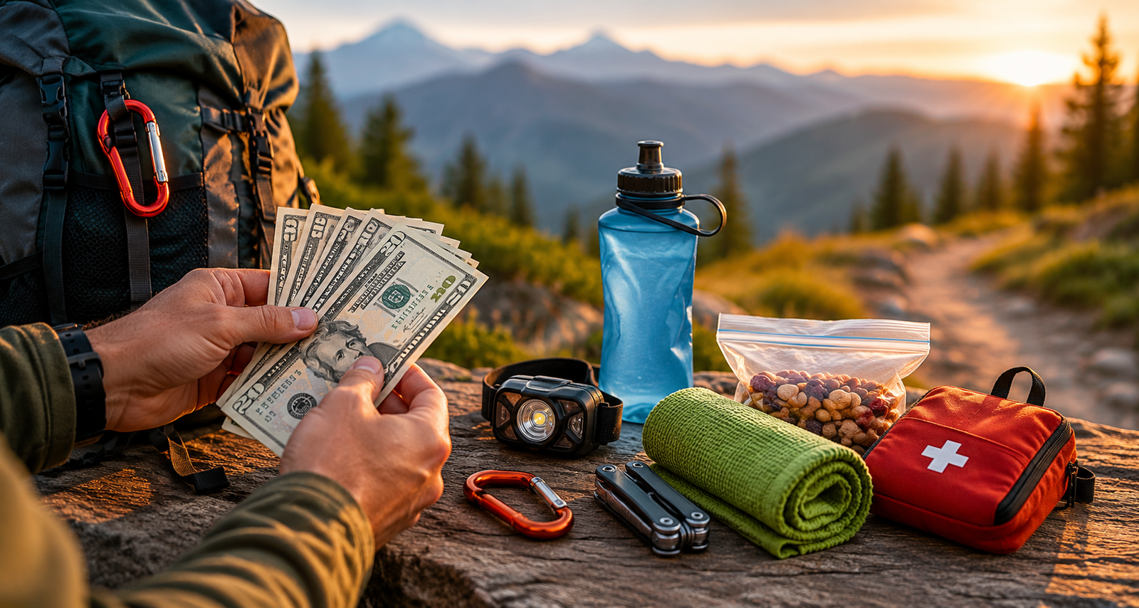
Budget Considerations for International Hidden Trails
Affordable Destinations
- Southeast Asia: Indonesia (Ijen), northern Thailand, Vietnam’s highlands
- Eastern Europe: Bulgaria, Romania, Albania
- South America: Bolivia, northern Peru (outside tourist zones)
- Central America: Guatemala, Honduras
Moderate Budget
- New Zealand: Higher costs but worth it for trail quality
- Iceland: Expensive but accessible hidden gems
- US National Forests: Free/cheap camping, moderate travel costs
Splurge-Worthy
- Patagonia: Remote locations mean higher logistics costs
- Antarctica: If you’re considering this, budget isn’t your concern
- Scandinavian Arctic: Remote, expensive, but unparalleled wilderness
Budget saving tips:
- Camp instead of using huts where possible
- Cook your own meals with a backpacking stove
- Visit during shoulder season for cheaper flights
- Join group tours to split guide/permit costs
- Use budget airlines for international trips
Safety Considerations for Remote Trails
Wildlife Encounters
Different regions require different precautions:
- Bear country: Bear spray, food storage, noise while hiking
- Mountain lion territory: Hike in groups, don’t hike at dawn/dusk
- Snake regions: Snake gaiters, watch where you step
- Insect-borne diseases: Permethrin-treated clothing, bug repellent
Weather Hazards
- Lightning: Get off ridges before afternoon thunderstorms
- Flash floods: Never camp in narrow canyons during monsoon season
- Hypothermia: Even summer hikes can turn deadly; pack emergency blanket
- Heat exhaustion: Start early, carry extra water, know the signs
Navigation Failures
- Download offline maps before leaving cell service
- Bring physical maps as backup
- Learn to use map and compass without technology
- Mark your route with biodegradable flagging in truly trailless areas
Medical Emergencies
- Take a Wilderness First Responder course
- Carry comprehensive first aid kit
- Know how to improvise splints, tourniquets, etc.
- Consider emergency evacuation insurance
Ethical Considerations: When to Share and When to Stay Quiet
This guide walks a fine line. We want to inspire hiking adventures but not destroy the solitude these trails offer. Here’s how to navigate this:
When It’s Okay to Share:
- Well-managed trails that can handle more visitors
- Trails in parks actively seeking tourism for funding
- General regions (not exact trailheads)
- Educational content that emphasizes Leave No Trace
When to Stay Quiet:
- Fragile ecosystems (cryptobiotic soil, rare plant habitats)
- Indigenous sacred sites
- Trails explicitly kept unpublished by land managers
- Your secret spot from your own exploration
How to Share Responsibly:
- Tag general areas, not exact GPS coordinates
- Include Leave No Trace reminders
- Mention difficulty honestly (don’t undersell challenges)
- Note permit requirements and seasonal closures
- Emphasize required skill levels
Building Your Hidden Trail Bucket List
Beginner-Friendly Secret Trails:
- Skútustaðagígar, Iceland (easy, accessible)
- Abel Tasman southern section (easy navigation)
- Mount Tamalpais West Ridge (strenuous but well-marked)
Intermediate Adventures:
- Enchanted Valley, Washington
- Gros Morne Coastal Trail
- Pelican Butte, Oregon
- Kawah Ijen rim walk
Advanced Expeditions:
- Sarek National Park, Sweden
- Zion Narrows top-down
- Ausangate back route
- Kilimanjaro Karanga variation
Training for Hidden Trail Adventures
Many secret trails demand more from hikers than popular, well-maintained routes. Here’s how to prepare:
Physical Conditioning (8-12 Weeks Before)
- Cardio base: Run, bike, or hike 3-4x weekly, building to 60+ minutes
- Weighted pack training: Start with 10 lbs, add 5 lbs weekly until matching trip weight
- Elevation simulation: Use stair climbers, stadium stairs, or local hills
- Back-to-back days: Practice consecutive hiking days to simulate multi-day trips
- Flexibility work: Yoga or stretching prevents injuries on uneven terrain
Technical Skills Training
- Navigation practice: Take map and compass courses in local parks
- River crossing techniques: Learn safe methods before you need them
- Campcraft: Practice setting up shelter in various conditions
- Food planning: Calculate calorie needs and test backpacking meals before trips
- Water sourcing: Learn to identify safe water sources and use filtration systems
Mental Preparation
- Solo vs. group decisions: Know your comfort level with solitude
- Risk tolerance: Assess your ability to handle uncertainty
- Problem-solving: Practice scenario planning for emergencies
- Patience training: Remote trails require flexibility when plans change
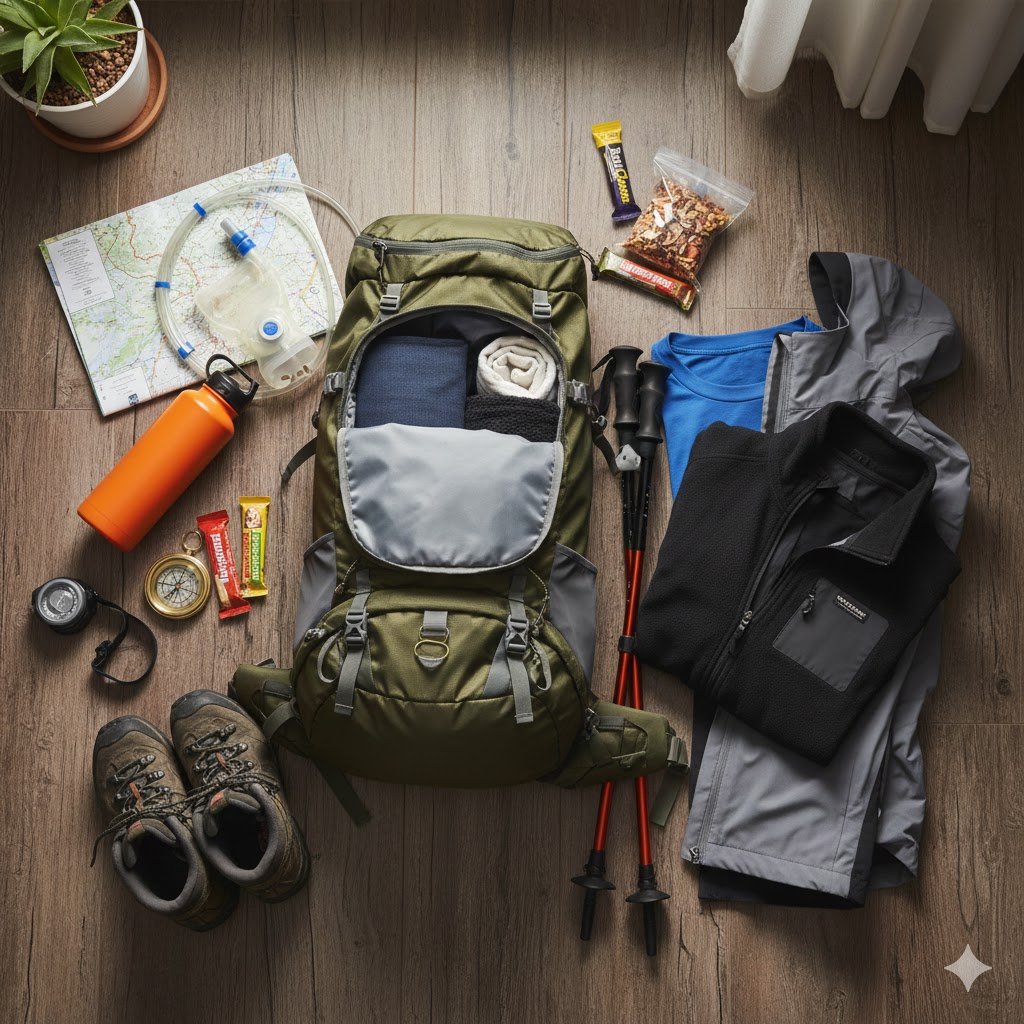
Packing Smart for Off-the-Beaten-Path Adventures
The Ultralight Philosophy
On remote trails, every ounce matters. Consider:
- Base weight target: Under 15 lbs for experienced hikers, 20 lbs for beginners
- Multi-use items: Trekking poles that become tent poles
- Eliminate luxuries: Be honest about what you actually need
- Weigh everything: Use a digital scale to track pack weight
Region-Specific Packing Lists
Desert Trails (Utah, Iceland volcanic areas):
- Sun umbrella for shade hiking
- Extra water capacity (dromedary bags)
- Gaiters for sand and volcanic ash
- Electrolyte supplements
- Reflective emergency blanket for heat
Rainforest/Wet Climate (Pacific Northwest, New Zealand):
- Waterproof pack liner or dry bags
- Quick-dry clothing only
- Waterproof stuff sacks for sleeping bag
- Insect head net
- Lightweight rain shell and pants
Alpine/High-Altitude (Kilimanjaro, Andes, Alps):
- Four-season sleeping bag
- Altitude medication
- Insulated water bottles (prevent freezing)
- Down jacket
- Hand warmers and toe warmers
Arctic/Subarctic (Sarek, Iceland winter):
- Vapor barrier liners for sleeping bag
- White gas stove (works in extreme cold)
- Expedition-grade sleeping pad (R-value 5+)
- Face protection (balaclava, goggles)
- Satellite communicator (essential)
Tech and Electronics
- Power solutions: Solar charger or battery bank
- Camera gear: Weather-sealed camera for conditions
- Navigation redundancy: Phone + GPS device + paper maps
- Entertainment: Kindle for lightweight reading
- Headlamp with extra batteries
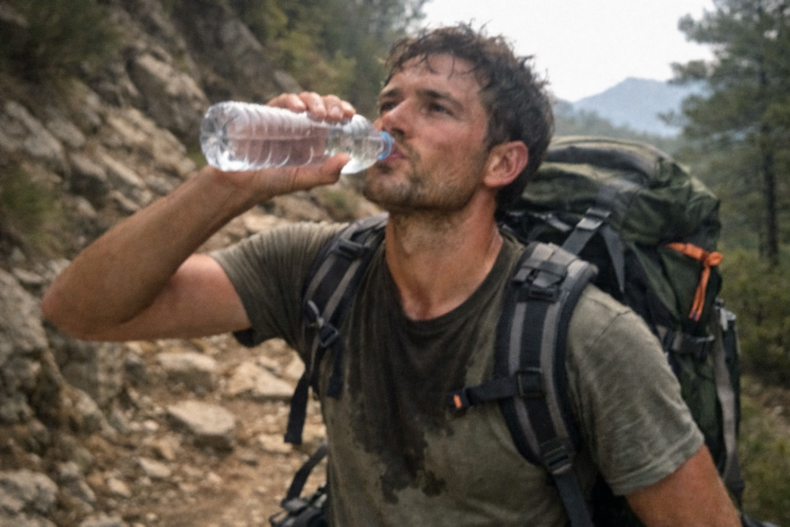
Food and Water Strategies for Remote Areas
Calorie Calculation
- Day hiking: 300-400 calories/hour
- Backpacking: 2,500-4,000 calories/day depending on pack weight and terrain
- High altitude: Add 20% more calories for adaptation
Lightweight Food Options
- Dehydrated meals: Easy and inexpensive if DYI
- High-calorie snacks: The Ultimate Guide to the Best Trail Snacks
- Treats for morale: Dark chocolate, hard candies
Water Treatment Methods
- Filter systems: Fast, no taste change
- Chemical treatment: Lightweight backup (chlorine dioxide tablets)
- UV purifier: Quick for clear water (SteriPEN)
- Boiling: Foolproof but fuel-intensive
Planning Water Carries
- Research water sources using trail reports
- In dry areas, carry capacity for 24-hour waterless stretches
- Morning vs. evening camps affect water strategy
- Collapsible water containers for camp use
Photography Tips for Hidden Trails
Capturing the Experience Without Crowds
One major advantage of secret trails: no photobombers!
Gear Recommendations:
- Lightweight setup: Mirrorless camera body + versatile zoom lens
- Smartphone excellence: Modern phones rival cameras for most situations
- Stabilization: Lightweight tripod or GorillaPod
- Protection: Weather-sealed camera bag
- Extra batteries: Cold drains power fast
Composition on Less-Photographed Trails:
- Find unique angles: Without existing photo references, be creative
- Tell the story: Capture the journey, not just the destination
- Include scale: Use your hiking partner or gear to show landscape size
- Golden hour priority: Wake early for best light
- Weather drama: Fog, storms, and clouds add mood
Ethical Photography:
- Don’t trample vegetation for shots
- Respect wildlife distance (telephoto lens recommended)
- Consider not posting exact locations of fragile areas
- Include Leave No Trace messaging in captions
Solo Hiking on Hidden Trails: Is It Safe?
The Solo Hiking Debate
Remote trails amplify both the risks and rewards of solo hiking.
Advantages:
- Complete freedom with pace and schedule
- Deep self-reflection and personal growth
- Heightened awareness and connection to surroundings
- No group dynamics or compromises
Risks:
- No help if injured
- Increased wildlife danger (appear less threatening alone)
- Navigation errors with no second opinion
- Psychological challenges of extended solitude
Solo Safety Protocols
- Communication plan:
- Detailed itinerary with check-in times
- Satellite communicator with SOS function
- Emergency contact card in pack
- Conservative decision-making:
- Turn back earlier than you would with partners
- Avoid technical scrambles when solo
- Don’t push through bad weather
- Enhanced first aid:
- Advanced first aid kit
- Training in self-rescue techniques
- Extra supplies since you can’t split weight
- Mental preparation:
- Build solo experience gradually
- Practice at-home alone time
- Bring journal for processing thoughts
Connecting with the Hiking Community
Finding Like-Minded Trail Partners
Don’t want to go solo? Find adventure partners through:
- Meetup.com hiking groups in your area
- Sierra Club and AMC outings (organized group trips)
- Reddit communities: r/CampingandHiking, r/WildernessBackpacking
- Facebook groups: Search “[Your City] Hiking Group”
- REI classes and events often include group hikes
- Trail running clubs: Faster pace but great community
Online Resources and Forums
- AllTrails: Reviews with recent conditions
- Gaia GPS: Detailed maps and route planning
- HikingProject.com: Comprehensive trail database
- Caltopo: Advanced mapping for route planning
- WhiteBlaze.net: Appalachian Trail and beyond
- Country-specific forums: Research “[Country name] hiking forum”
Guided Trips for First-Timers
Consider guided trips for:
- High-altitude expeditions (Kilimanjaro)
- International destinations with language barriers
- Technical routes requiring rope skills
- Arctic/extreme environments
- Your first multi-day backpacking trip
Reputable guide services:
- Research companies with Leave No Trace certifications
- Check guide-to-client ratios (smaller is better)
- Read reviews on multiple platforms
- Verify insurance and permits
- Ask about environmental practices
Converting Hidden Trail Hikes Into Bucket List Trips
Planning Your First International Hiking Trip
12 Months Before:
- Research destinations and get passport if needed
- Set budget and start saving
- Book major flights when prices drop
- Research visa requirements
6 Months Before:
- Reserve permits for popular trails
- Get required vaccinations
- Buy travel insurance with adventure coverage
- Start physical training program
- Purchase major gear items (backpack, boots, sleeping bag)
3 Months Before:
- Book accommodations pre/post-trek
- Arrange ground transportation or guides
- Test all gear on local training hikes
- Research travel adapters and currency
- Download offline maps and translation apps
1 Month Before:
- Break in new boots completely
- Finalize packing list
- Make copies of important documents
- Notify bank of travel plans
- Pack first aid supplies and medications
1 Week Before:
- Check weather forecasts
- Confirm all reservations
- Pack and weigh everything
- Leave copies of itinerary with emergency contact
- Charge all electronics and battery packs
Budget Breakdown: Sample Trip Costs
Example: 10-Day Iceland Hidden Trails Trip
- Flights: $400-800 (depending on season)
- Rental car: $600-900 (4WD necessary)
- Camping/huts: $30-60/night = $300-600
- Food: $400-600 (groceries from Bonus stores)
- Gas: $200
- Park fees: $50
- Gear rentals: $100-200 (if needed)
- Total: $2,050-3,350
Budget Version:
- Camp exclusively ($300)
- Cook all meals ($300)
- Travel shoulder season (May/Sept)
- Share rental car costs
- Total: $1,500-2,000
Environmental Impact and Sustainable Trail Tourism
The Paradox of Sharing
Every article like this risks loving places to death. Here’s how to hike responsibly:
Leave No Trace Seven Principles:
- Plan ahead and prepare – Reduces resource damage
- Travel on durable surfaces – Stick to trails
- Dispose of waste properly – Pack it ALL out
- Leave what you find – No souvenirs
- Minimize campfire impacts – Use camp stoves
- Respect wildlife – Observe from distance
- Be considerate – Keep noise down, yield trail
Carbon Offset Considerations
Long-distance flights have environmental costs. Consider:
- Offset programs: Cool Effect, Atmosfair
- Slow travel: Combine multiple trails in one trip
- Local first: Explore trails near home before flying internationally
- Public transport: Use buses/trains when possible
- Group trips: Share carbon footprint
Supporting Local Conservation
- Pay trail fees cheerfully—they fund maintenance
- Donate to local conservation organizations
- Hire local guides and porters
- Buy from local businesses
- Volunteer for trail work days
- Join trail maintenance organizations
Dealing with Challenges: When Things Go Wrong
Common Trail Problems and Solutions
Problem: Blisters
- Prevention: Break in boots, wear liner socks
- Treatment: Moleskin at first hot spot, don’t pop blisters
- Recovery: Leukotape for continued hiking
Problem: Getting Lost
- Prevention: Regular map checks, waypoints, note landmarks
- Solution: Stop immediately, don’t go further. Use compass to backtrack
- Last resort: Stay put, use whistle or signal mirror
Problem: Weather Turn
- Prevention: Check forecasts, watch cloud patterns, start early
- Solution: Emergency shelter, get off ridges, assess hypothermia risk
- Decision point: Know when to turn back vs. push through
Problem: Wildlife Encounter
- Bear: Back away slowly, speak calmly, use spray if charged
- Mountain lion: Face it, appear large, don’t run, fight if attacked
- Moose: Give wide berth (more dangerous than bears)
- Snakes: Back away slowly, don’t try to kill or capture
Problem: Running Low on Water
- Rationing: Don’t dehydrate to save water; drink what you need
- Finding sources: Look for green vegetation, follow animal trails downhill
- Treatment: Use backup purification tablets if filter fails
Problem: Injury on Trail
- Assess: Can you self-evacuate or need rescue?
- Signal: Satellite SOS, whistle (3 blasts), visible location
- Stabilize: First aid, prevent shock, stay warm
- Wait: Conserve energy if rescue is coming
The Psychology of Solitude: Mental Health Benefits of Hidden Trails
Why Remote Hiking Is Good for Your Brain
Backed by Science:
- Reduced rumination: Nature walks decrease repetitive negative thoughts
- Improved attention: “Soft fascination” restores mental energy
- Stress reduction: Cortisol levels drop significantly during forest hiking
- Creativity boost: Problem-solving improves after multi-day backcountry trips
- Perspective gains: Physical challenges build mental resilience
Mindful Hiking Practices
- Walking meditation: Focus on breath and footsteps
- Sensory awareness: Notice 5 things you see, 4 you hear, 3 you feel, 2 you smell, 1 you taste
- Gratitude practice: Daily journal entries about trail gifts
- Phone-free zones: Resist the urge to document everything
- Sit spots: Spend 20 minutes stationary, observing
Dealing with Trail Anxiety
Remote trails can trigger fears. Coping strategies:
- Name the fear: Acknowledging anxiety reduces its power
- Reality check: Most fears are statistically unlikely
- Breathing exercises: 4-7-8 breathing calms nervous system
- Gradual exposure: Build confidence on easier trails first
- Partner system: Go with experienced friends initially
Seasonal Guide: When to Hike These Hidden Gems
Winter (December-February)
Best destinations:
- New Zealand trails (summer there)
- Low-elevation California trails
- Desert Southwest trails
- Hawaii backcountry
Avoid:
- High-altitude routes
- Scandinavia (unless winter-equipped)
- Most of the list above
Spring (March-May)
Best destinations:
- Desert trails before extreme heat
- California wildflower trails
- Nepal pre-monsoon
- Patagonia (their fall)
Trail conditions:
- Mud season in many areas
- Snow lingering at elevation
- Waterfalls at peak flow
Summer (June-August)
Best destinations:
- High-altitude routes now accessible
- Iceland, Scandinavia optimal
- Canadian Rockies
- Alps and Pyrenees
Considerations:
- Even secret trails see relative crowds
- Bugs peak in some regions
- Book permits far in advance
Fall (September-November)
Best destinations:
- Best overall season for many trails
- Deciduous forest color displays
- Shoulder season pricing
- Stable weather in many regions
Watch for:
- Earlier snowfall at altitude
- Shorter daylight hours
- Some facilities closing
Expert Interviews: Tips from Experienced Hidden Trail Hikers
What Experienced Hikers Wish They’d Known
“Start with overnight trips near home before international expeditions.” Build skills locally where mistakes have smaller consequences.
“The best trail is the one you’ll actually do.” Don’t let perfectionism prevent you from hiking. Start somewhere.
“Invest in good boots and a good sleeping pad—everything else can be budget.” Sore feet and poor sleep ruin trips faster than anything.
“Learn to be bored without your phone.” The ability to sit with yourself is essential for remote trails.
“Bad weather makes the best stories.” Don’t let rain stop you—some of the most memorable moments happen in storms.
“Go slow to go far.” Pace yourself, especially at altitude. Tortoise beats hare every time.
Conclusion: Your Hidden Trail Journey Starts Now
The world’s most remarkable hiking experiences aren’t always found on Instagram’s explore page or atop bestseller guidebooks. They’re discovered by curious hikers willing to dig deeper, walk farther, and embrace uncertainty.
These 15 hidden gem trails represent just a fraction of the world’s undiscovered hiking treasures. Each offers something the crowded trails cannot: genuine solitude, authentic wilderness encounters, and the profound satisfaction of discovering something special largely on your own terms.
Your Action Plan:
This Week:
- Choose one trail from this list that matches your skill level
- Join a local hiking group or forum
- Audit your current hiking gear
This Month:
- Complete a training hike with full pack weight
- Research permits and logistics for your chosen trail
- Start physical conditioning program
This Season:
- Book your trip (or at least set a target date)
- Invest in any missing essential gear
- Practice navigation skills locally
This Year:
- Complete your first hidden gem trail
- Share your experience responsibly
- Plan your next adventure
Final Reminders:
The beauty of these trails lies not just in their scenery but in their relative obscurity. As you explore them, remember:
- Respect the solitude that makes them special
- Protect the environment that sustains them
- Support the communities that steward them
- Challenge yourself to grow as a hiker
- Share responsibly to inspire without destroying
The trail less travelled awaits. Every journey begins with a single step—often onto a path that few have discovered before you.
Where will your hidden trail journey take you first?
Useful resources:
- Hot weather hiking: How to Survive Hiking in Summer
- Winter Hiking: Your Complete Guide to Gear, Safety, and Cold Weather Hikes
- The Best Hiking Backpacks: The Complete Guide
- How to Plan a Hiking Trip: Complete Guide for Beginners & Experts
- The Ultimate Hiking Gear Guide: What You Actually Need (Tested & Approved)
Leave a Reply